Lost Revolutionary War fort was hiding a foot underground in North Carolina
The “footprint” of a lost Revolutionary War era fort has been rediscovered on a bluff overlooking a valley in North Carolina, according to researchers at Appalachian State University.
Read more Hairlike tufts poked out of a 200-year-old kitchen wall in NC. They weren’t hair
Known as Fort Defiance, the fortification near Lenoir, North Carolina, was built in 1776 to shelter settlers from attacks by Native Americans, but there are few historical accounts detailing its existence, appearance and demise.
Many of the questions surrounding the fort can now be answered, thanks to a student research project guided by Dr. Ellen Cowan of Appalachian State University.
“The work sheds light on enduring mysteries of how the fort was constructed, its size and configuration,” the university wrote in a Nov. 12 news release.
Ground-penetrating radar found the fort adjacent to the restored 18th century home of Maj. General William Lenoir, which is popularly known as Fort Defiance.
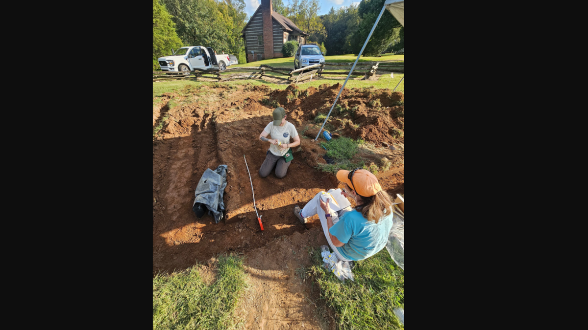
Remnants of the buildings were located about a foot deep – just beyond the reach of plows, university officials said.
“There was a lot of disagreement in the past about where the fort could be,” according to Cowan, a professor in the Department of Geological and Environmental Sciences.
“There were many such fort sites built in western North Carolina in the 1700s, but their locations often remain unknown, erased by changing land uses or buried under parking lots. Fort Defiance is unique because the area has not been built on, and the disturbance has been minimal.”
Read more A kitten was stuck 20 feet up a tree. A North Carolina cop had a plan: Tuna
Excavation work in early October led to “traces of a blockhouse, cabin and palisade wall,” the university said. The team also found pottery sherds, pieces of metal and “stains and impressions” from logs, which revealed construction methods for the 80-by-100-foot fort, officials said.
Among the lingering questions is whether the fort was ever attacked by the Cherokee, and if it burned down or was simply dismantled after being abandoned, historians say.
Appalachian State faculty and student researchers have been investigating the site since the 2023–24 academic year, when ground-penetrating radar found “hard lines with right angles beneath a field,” officials said.
“We know from records that General William Lenoir purchased the ‘fort tract’ to build his house, but that was a large enough area to leave the exact location up for debate,” Cowan says.
“The fort was present on the landscape when Maj. General William Lenoir established the family cemetery by burying his 2-year-old daughter in 1785 and when his house was constructed across the road in 1792.”
A digital rendering of the fort’s layout will now be commissioned by the American Battlefield Trust as part of the Liberty Trail N.C. project, officials said. The trail commemorates Revolutionary War history and sites linked to the 250th anniversary of the signing of the Declaration of Independence.
“Future visitors will be able to use their phones to see an AR (augmented reality) rendering of the fort exactly where it stood, with the current landscape as a backdrop,” university officials said in the release.
Read more City is closing its ‘Jungle’ homeless camp one section at a time in Washington state
Fort Defiance is about an 85-mile drive northwest from uptown Charlotte.











Post Comment