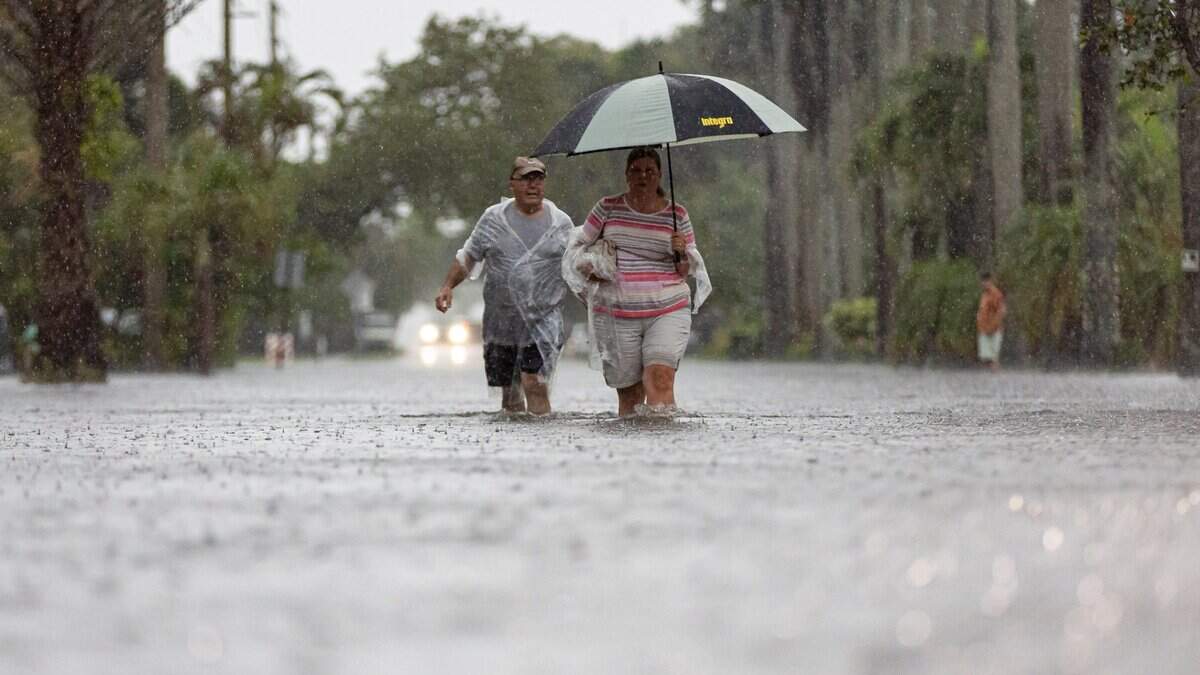
Heavy rain, floods expected in Miami area. ‘That is how juicy the atmosphere is’
When the high-temperature forecast and the chance for rain numbers start to merge, you know it’s going to be a washout.
Read more Heavy rain, floods expected in Miami area. ‘That is how juicy the atmosphere is’
That’s the scenario the National Weather Service in Miami’s Sammy Hadi and CBS News Miami meteorologist Lissette Gonzalez have for South Florida this week — the second week in a row of daily downpours.
Highs are expected in the upper 80s and the rain chances for the week through Sunday hover around the 80% range — especially Wednesday when the weather service puts storm chances at 88%. That’s higher than the 86 degree temperature forecast.
Rainy days and Mondays and a whole week’s worth.
Hadi and Gonzalez call for a risk of flooding because of heavy downpours Monday, Tuesday and Wednesday. There’s a marginal risk of excessive rainfall for each afternoon through Wednesday, according to the weather service.
“Most likely rainfall amounts of 2-6 inches are forecast over the next seven days with a reasonable worst case — 1 in 10 chance — scenario of receiving 6 to 15 inches of rainfall through next Monday,” Hadi said about South Florida’s week ahead.
“You’ll need those umbrellas. The kids will need those rain jackets as many head back to school tomorrow after the holiday today,” Gonzalez said on Monday morning, referring to school closures due to Yom Kippur, the holiest day in the Jewish calendar. “It is looking soggy and unsettled through the rest of the week and into the weekend.”
When the observant celebrating Yom Kippur break the fast around dinner time Monday, rain chances in the Miami area between 5 p.m. and 8 p.m. will be about 50%.
All of South Florida faces the same forecast, but Fort Lauderdale could be the wettest spot, National Weather Service meteorologist George Rizzuto said in his Monday report.
Read more Chargers S Derwin James (finger) to play with cast
“The Weather Prediction Center is forecasting most likely rainfall amounts of 5-7 inches for the City of Fort Lauderdale over the next seven days with a reasonable worst case — 1 in 10 chance scenario — of receiving 8-10 inches of rainfall through Saturday,” he said.
The reason? “A low-pressure system in the upper levels of the atmosphere is pumping in that deep tropical moisture and that is how juicy the atmosphere is right now,” Gonzalez said.
Timing for the wettest weather
Here’s the timing for the highest chance for rain and thunderstorms this week, according to the National Weather Service in Miami’s forecast points checker.
- Monday: 70% between 2 and 3 p.m.
- Tuesday: 70% between 2 and 4 p.m. and again from 8 p.m. to midnight.
- Wednesday: 90% between 2 and 7 p.m.
- Thursday: 80% between 2 and 7 p.m.
- Friday: 70% between 2 and 7 p.m.
- Saturday: 70% between 2 and 7 p.m.
- Sunday: 60% between 2 and 7 p.m.
Tropical storm Fay
Tropical storm Fay could have become the season’s first hurricane, but its chances have fallen, according to the National Hurricane Center. Maximum sustained winds have decreased to near 65 mph on Monday morning.
“Continued weakening is forecast, and Fay could degenerate to a post-tropical cyclone in a day or two,” said hurricane center forecaster John Cangialosi in Monday’s 9 a.m. advisory.
“Tropical Storm Fay is not a threat to South Florida,” CBS’ Gonzalez said Monday as the system is expected to decline in the open waters of the Atlantic into Thursday.
Read more Why the fight over OLF 8 code could shape Beulah’s future










Post Comment