Here’s what National Hurricane Center in Florida is tracking today
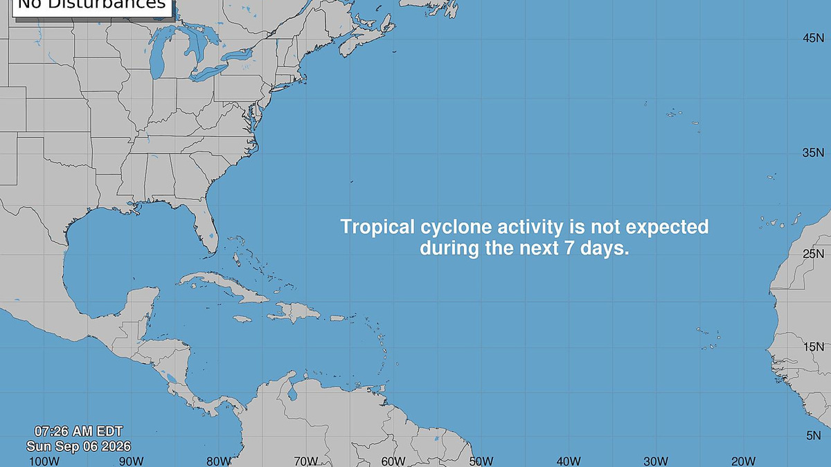
The tropics remain calm on Sunday, Sept. 6, with no tropical cyclone formation expected over the next week for the Atlantic Basin, including the Gulf, according to the latest update from the National Hurricane Center in Miami, Florida.
Read more Saturday’s only major lottery draw game winner was bought at a liquor store
The hurricane center is tracking four tropical waves, and while they are often the starting point for tropical storms, there is currently no threat to Florida or the U.S.
There’s currently no tropical threat to Florida, but conditions can change rapidly. Forecasters encourage residents to stay prepared.
Here’s what you should know based on the latest advisory from the National Hurricane Center as of 8 a.m., Sept. 6.
Shop Amazon for hurricane prep
NHC tracking 4 tropical waves in Atlantic basin
The National Hurricane Center is monitoring four tropical waves Saturday, Sept. 5, with one potential wave expected to be added to the list.
- The axis of a tropical wave is near 22W, south of 20N, moving W at 10 to 15 kt. Scattered moderate convection is noted from 08N to 12N between 22W and 25W.
- The axis of a tropical wave is near 37N, south of 20N, moving W at around 10 to 15 kt. Scattered showers are seen near the wave axis and S of 15N.
- The axis of a tropical wave is near 68W, south of 20N, moving W at around 10 to 15 kt. Scattered showers are near the northern end of the wave axis mainly between 65W and 70W.
- The axis of a tropical wave is near 79W, and extends from central Cuba southward into the far eastern Pacific. No significant convection is noted in the Caribbean waters with this wave.
➤ Weather alerts via text: Sign up to get updates about current storms and weather events by location
What is a tropical wave?
“Tropical waves are clusters of showers and thunderstorms that act as the seedlings for many tropical storms throughout the Atlantic season,” said Alex DaSilva, AccuWeather lead hurricane expert, via email.
“There are about 60 tropical waves that move across the Atlantic each year, and roughly 10 percent to 15 percent of them develop into a tropical system. That’s about one in seven.
“Tropical waves are important because they contribute to about 80 percent of all major hurricanes.”
When is hurricane season in Florida?
The Atlantic hurricane season runs from June 1 through Nov. 30.
Ninety-seven percent of tropical cyclone activity occurs during this time period, NOAA said.
➤ Hurricane Center testing new cone: What’s changing this season?
The Atlantic basin includes the northern Atlantic Ocean, Caribbean Sea and Gulf of America, as the Gulf of Mexico is now known in the U.S. per an order from President Trump. NOAA and the National Hurricane Center are now using Gulf of America on its maps and in its advisories.
Read more Aaron Philo’s Florida debut a winner as Gators hammer FAU
What do the colored, hatched areas on the NHC map mean?
The hatched areas on the National Hurricane Center’s tropical outlook map indicate “areas where a tropical cyclone – which could be a tropical depression, tropical storm or hurricane – could develop,” said National Hurricane Center Deputy Director Jamie Rhome.
➤ Hurricane Center is testing new cone: What’s changing the season
The colors make it visibly clear how likely a system could develop, with orange medium and red high. In 2026, the tropical outlook will use a gray X to indicate disturbances with a low chance for development.
The National Hurricane Center generally doesn’t issue tropical advisories until there is a named storm, but there is an exception.
“If a system is near land and there is potential for development, the National Hurricane Center won’t wait before it issues advisories, even if the system hasn’t become an actual storm. This gives residents time to prepare,” Rhome said.
Florida weather radar for Sept. 6, 2026
Florida weather watches and warnings
2026 hurricane names
Here are the names for the 2026 Atlantic hurricane season and how to pronounce them:
Arthur: Tropical Storm Arthur formed June 17, 2026Bertha: Tropical Storm Bertha formed July 20, 2026Cristobal: Tropical Storm Cristobal formed Aug. 12, 2026Dolly, DAH-leeEdouard, eh-DWARD- Fay, fay
- Gonzalo, gohn-SAH-loh
- Hanna, HAN-uh
- Isaias, ees-ah-EE-ahs
- Josephine, JOH-seh-feen
- Kyle, KY-ull
- Leah, LEE-ah
- Marco, MAR-koe
- Nana, NA-na
- Omar, OH-mar
- Paulette, pawl-LET
- Rene, re-NAY
- Sally, SAL-ee
- Teddy, TEHD-ee
- Vicky, VIH-kee
- Wilfred, WILL-fred
Stay informed. Get weather alerts via text
What’s next?
We will continue to update our tropical weather coverage to bring you the most current information you need to protect your home and family.
Kim Luciani is a journalist for the USA TODAY Network-Florida’s Audience team. You can get all of Florida’s best content directly in your inbox each weekday by signing up for the free newsletter, Florida TODAY, at https://tcpalm.com/newsletters.
This article originally appeared on Naples Daily News: Here’s what National Hurricane Center in Florida is tracking today
Our editors independently choose our recommendations. Some content is produced with paid support from a third party, however our editorial decisions remain independent. If you buy through our links, the USA TODAY Network may earn a commission. Prices and availability may change.
Reporting by Kim Luciani and Cheryl McCloud, USA TODAY NETWORK – Florida / Naples Daily News
Read more Sumrall debuts as Gators coach with rout of FAU
USA TODAY Network via Reuters Connect
Copyright Reuters or USA Today Network via Reuters Connect
This story was originally published September 6, 2026 at 9:43 AM.










Post Comment